

Quick answer
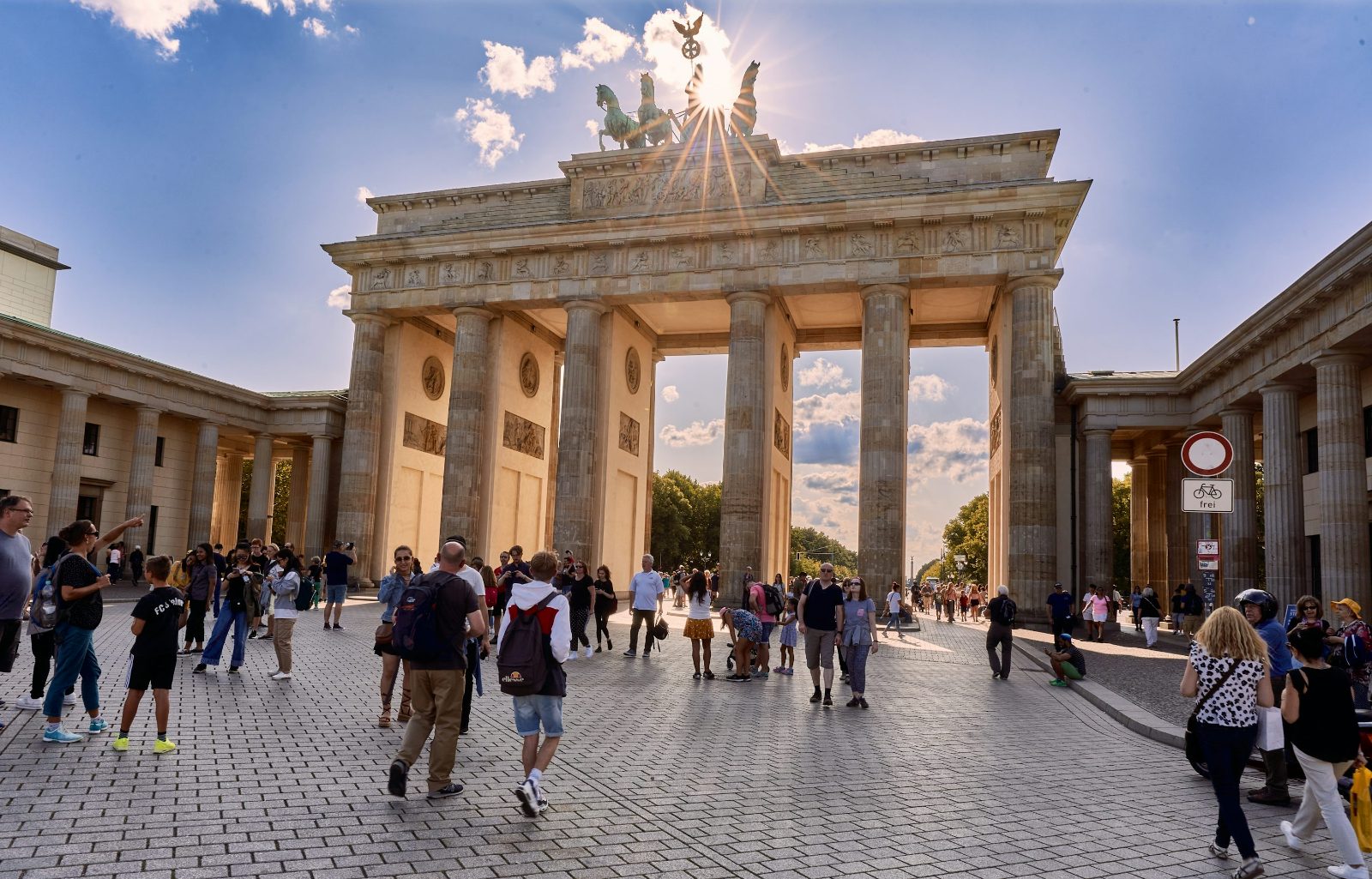
Berlin is moderately walkable within its central districts, where landmarks like the Brandenburg Gate, Museum Island, and Checkpoint Charlie lie within 2 to 3 kilometers of each other. The city's broad boulevards, continuous sidewalks, and pedestrian crossings support walking, but distances between outer neighborhoods often exceed comfortable walking range. Most visitors combine short walks with U-Bahn or S-Bahn segments to cover ground efficiently without fatigue.
Berlin's street grid dates to the 19th century, when royal planners laid wide avenues like Unter den Linden to accommodate military parades and carriage traffic. That legacy gives the city generous sidewalks and predictable intersections, but it also stretched distances — the walk from Alexanderplatz to Zoologischer Garten measures 6 kilometers, a 75-minute trek most visitors break into segments. The most pedestrian-friendly zone runs from Museum Island through the Brandenburg Gate to Potsdamer Platz, a 2.5-kilometer corridor that strings together five major sites with minimal elevation change. Kreuzberg and Friedrichshain offer dense, walkable streets where cafes, shops, and parks sit within 500 meters of each other, making neighborhood exploration practical on foot. Prenzlauer Berg's tree-lined residential blocks reward slower walks, though its attractions scatter across a wider area. Berlin's public transit fills the gaps walking cannot. The U-Bahn and S-Bahn networks place stations every 600 to 800 meters in central districts, letting you walk a neighborhood thoroughly, then hop a train to the next cluster. A day ticket costs 8.80 EUR and removes the friction of deciding whether a 2-kilometer walk justifies the effort. The city lacks the steep hills that punish pedestrians in Lisbon or San Francisco, but its scale demands selective walking — choose neighborhoods, not the full city. Pedestrian signals follow German precision: countdowns display remaining seconds, and right-turning vehicles yield to crosswalks. Wide cycle lanes run parallel to many sidewalks, separated by a low curb or paint stripe. Berlin walking works best between 09:00 and 18:00, when daylight and moderate crowds make navigation straightforward. Rain gear matters — the city averages 12 rainy days per month in spring and autumn, and finding shelter mid-route can stretch a 20-minute walk into 40.
“Berlin's most walkable corridor strings together Museum Island, Brandenburg Gate, and Potsdamer Platz in a 2.5-kilometer line with minimal elevation change.”
When Is Berlin Walkable and Optimal for Sightseeing?
Berlin is most walkable between 09:00 and 18:00, which provides optimal daylight and moderate pedestrian traffic for navigating city landmarks. Planning your walk within this window balances visibility with comfortable crowd levels.
May to June
ModerateMild, 15°C to 22°C
Clear skies and pleasant temperatures favor extensive walking routes. This period precedes the peak summer heat and tourist density.
July to August
HighWarm, 18°C to 25°C
Long daylight hours allow for evening walks, though popular sites experience heavier foot traffic. Prepare for occasional humidity.
September to October
ModerateCool, 10°C to 18°C
Crisp autumn air provides comfortable conditions for long-distance city exploration. Pedestrian traffic begins to decline as the season progresses.
Weekday Mornings
Low—
Early hours offer the quietest streets and the easiest access to central monuments. This timeframe minimizes congestion in pedestrian zones.
Verdict: The best period to visit is from Tuesday to Thursday between 09:00 and 18:00 during the months of May or September.
How to Reach Walkable Zones in Berlin
Berlin is structured as a collection of distinct, pedestrian-friendly districts, though the city's overall scale often requires using public transit to connect major landmarks. The U-Bahn and S-Bahn networks provide the most efficient way to travel between these walkable areas.
U-Bahn line U5 to Brandenburger Tor station
S-Bahn lines S1, S2, or S25 to S+U Brandenburger Tor
Line 100 to Reichstag/Bundestag
Walk from Unter den Linden to Pariser Platz
Is Berlin Walkable for All Mobility Levels?
Berlin maintains high accessibility standards, though the prevalence of historic cobblestones in some districts can impact ease of travel. Most modern infrastructure, including public transit and primary landmarks, incorporates designated step-free routes and universal access features.
Historic cobblestone sections may require route planning to avoid uneven surfaces.
Main pedestrian paths and major sidewalks are equipped with curb cuts.
Most U-Bahn and S-Bahn stations provide functioning elevator access to platforms.
Public facilities in central areas often include compliant stalls for mobility devices.
Tactile paving exists at most crosswalks, and some transit lines offer audio announcements.
How to Plan a Walkable Berlin Itinerary
This plan suits visitors who want to explore Berlin's core landmarks on foot, covering three compact clusters across a full day with minimal transit between zones.
Start in Mitte
Begin at Brandenburg Gate and walk east through Pariser Platz. Allow 90 minutes to reach Museum Island via Unter den Linden, passing the Reichstag and Berlin Cathedral on foot.
Museum Island Circuit
Explore the island's exterior architecture and bridge views without entering museums. The perimeter loop takes 30–40 minutes and connects directly to Alexanderplatz.
Alexanderplatz to Hackescher Markt
Walk south through the courtyards of Hackesche Höfe, covering 1.2 km in 15 minutes. Stop for lunch in the Scheunenviertel neighborhood before continuing.
Kreuzberg Walk
Take the U-Bahn to Kottbusser Tor (8 minutes), then walk the canal paths toward Görlitzer Park. This 2 km stretch shows residential Berlin and street art, taking roughly 45 minutes at a steady pace.
East Side Gallery
Walk northeast along Mühlenstraße to see the preserved Wall murals—1.3 km of open-air gallery accessible 24 hours. Budget 40 minutes to walk the full length without backtracking.
Return to Mitte
Walk back across Oberbaumbrücke or take the S-Bahn two stops to Friedrichstraße. End near Gendarmenmarkt for evening options, completing the loop.
Interesting Facts About Why Is Berlin Walkable
Berlin's urban layout is defined by its polycentric structure, featuring a collection of diverse neighborhoods that function as independent hubs. This unique design encourages exploration on foot, as each district offers a distinct atmosphere and local character.
12 Kiez districts
Berlin is organized into distinct neighborhoods known as Kiez, each providing residents and visitors with local services and pedestrian-friendly streets.
96 distinct localities
The city is composed of 96 diverse localities, ensuring that points of interest are distributed across a wide geographic area rather than confined to a single center.
170 museums
Berlin hosts approximately 170 museums, many of which are clustered within walkable distances in areas like Museum Island.
3,500 hectares of parks
The city contains over 3,500 hectares of public green space, allowing pedestrians to traverse large sections of the city through interconnected park systems.
12,000 streets
Berlin's infrastructure consists of over 12,000 streets, creating a dense grid that supports navigation and walking routes throughout the city.
Historical Kiez culture
The traditional Kiez concept emphasizes short distances between housing, markets, and public squares, which remains a core feature of Berlin's walkability today.
Checklist for Those Asking Is Berlin Walkable
A few essentials ensure you can navigate Berlin's districts comfortably on foot.
-
Wear broken-in walking shoes — Cobblestone streets and long distances demand supportive footwear.
-
Download an offline map app — Cell signal drops in parks and U-Bahn stations between neighborhoods.
-
Check the hourly weather forecast — Berlin's climate shifts quickly, bringing sudden rain or wind.
-
Pack a lightweight waterproof jacket — Afternoon showers are common, even during dry seasons.
-
Charge your phone fully before departure — Navigation and photo opportunities drain batteries faster than expected.
-
Bring a refillable water bottle — Fountain access is limited in some districts, especially along the Spree.
Check availability
Frequently Asked Questions: Is Berlin Walkable?
Everything you need to know about is berlin walkable